Harbor/Doheny Doheny Doheny
Dana Point Area Photos and Information
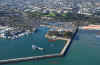
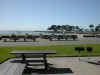
Harbor/Doheny
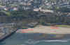
Doheny
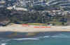
Doheny
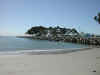
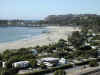
Doheny Beach Area #12
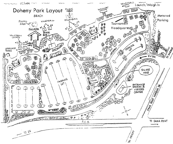
HQs Camp Sites
From Los Angeles and Orange Counties: Take Interstate 5 south to the Pacific Coast Highway/Camino Las Ramblas off-ramp (approximately 15 miles south of the Interstate 405 and 5 Interchange). As soon as you exit the freeway you will come to a fork; bear right. You are now on Pacific Coast Highway (northbound). Dana Point Harbor Drive is about 1 mile from the Freeway and is at the second traffic light. As you approach this intersection, Denny's restaurant will be on your right. Turn left onto Dana Point Harbor Drive. The State Beach entrance will be to your left at the first traffic light.
From San Diego County: Take Interstate 5 north to the Beach Cities/Camino Las Ramblas off-ramp. Once you leave the freeway get into the left lane. After you pass through the tunnel you will be on Pacific Coast Highway. Continue about 3/4 mile to the second traffic light which is Dana Point Harbor Drive. As you approach this intersection, Denny's restaurant will be on your right. Turn left onto Dana Point Harbor Drive. The State Beach entrance will be to your left at the first traffic light.
The tournament headquarters is area #12. We recommend using the State Parking lot which opens at 5:00am. Parking is $10 dollars for the day (If you're camping at Doheny you should already have a parking pass taped to the inside of your windshield). We've made arrangements to have both a parking attendant and Park Ranger at Doheny at 5am. Please do not pull into the park before 5:00am. If for some reason you were to pull in the park before the parking attendant arrived, please be sure to retrieve a pass as soon as they open. Vehicles without a pass will be cited. Please do not use the adjacent harbor parking lot or launch and land from the boat ramps.
Permission to use aerial photos was granted by the
California Coastal Protection Project
Copyright (C) 2002-2003 Kenneth Adelman, California Coastal Records
Project, www.Californiacoastline.org